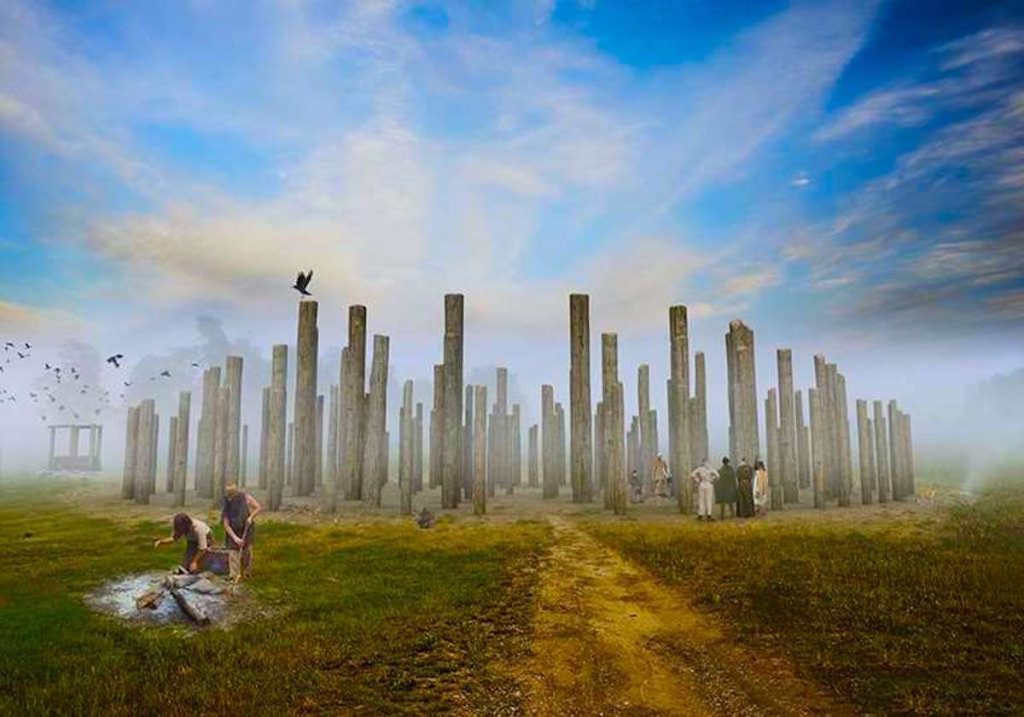
Woodhenge is a neolithic construction in present-day Wiltshire, England, that consisted of six concentric rings of timber dating to around 2500 BC. The mysterious site is located only two miles from Stonehenge north of Amesbury off Fargo Rd. The coordinates are 51.189379°N 1.785732°W. In 1986, it became designated a UNESCO World Heritage site.
The large henge links to Stonehenge via parallel banks and ditches running 70 to 110 feet apart. Although Woodhenge is much less visited than its more famous counterpart, it is nonetheless a very interesting site and most likely built by the same people that erected Stonehenge.
Discovery
In December 1925, squadron leader Gilbert Insall discovered an anomaly on the ground after reviewing an aerial photograph. Initially, most people assumed the location was a disc barrow. Because of that, they named the location Dough Barrow.
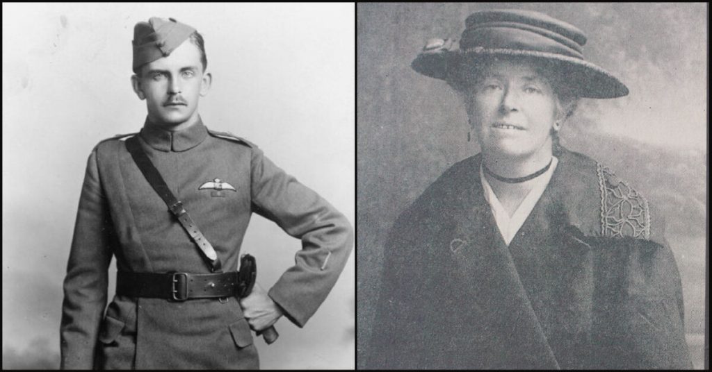
Between 1926 and 1928, Maud and Benjamin Cunnington excavated the area. Making sense of the site was an incredible task. The plowing of farms over the years nearly destroyed all traces of the bank and ditch surrounding the site. Through their work, they discovered the various postholes in concentric rings. Realizing it is a henge, experts renamed the site Woodhenge.
Description
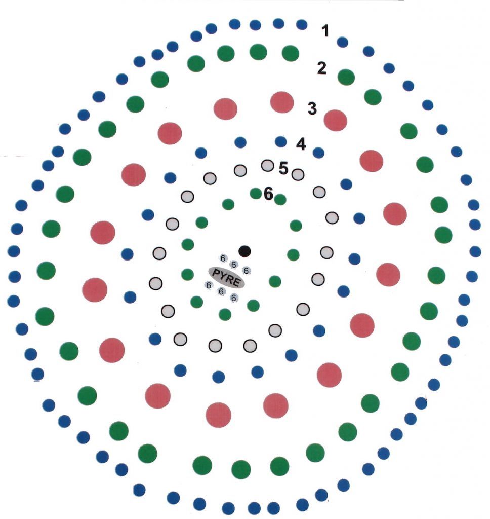
Woodhenge, including the surrounding bank and ditch, is 360 feet in diameter (English-Heritage.org.uk). An entrance on the northeast leads to the wooden posts that lay in six concentric oval rings. The erected timbers came in varying heights, depending on the ring. The most massive posts lay in Ring C (the thrid largest ring from the outside) and measured approximately 31 feet high (stone-circles.org.uk).
An outer bank once stood around the site. The bank spanned 33 feet with a height of a little over three feet.
Immediately after the bank lay a ditch. The ditch contained a flat bottom measuring 40 feet wide by eight feet deep. However, it is one of the newer additions to the site, dating from 2400-2100 BC.
Related: Mysteries of Silbury Hill
Due to the land being re-worked over time, researchers are not certain exactly how this site looked. There seems to be agreement that it was uncovered, without a roof or ceiling.
Rings
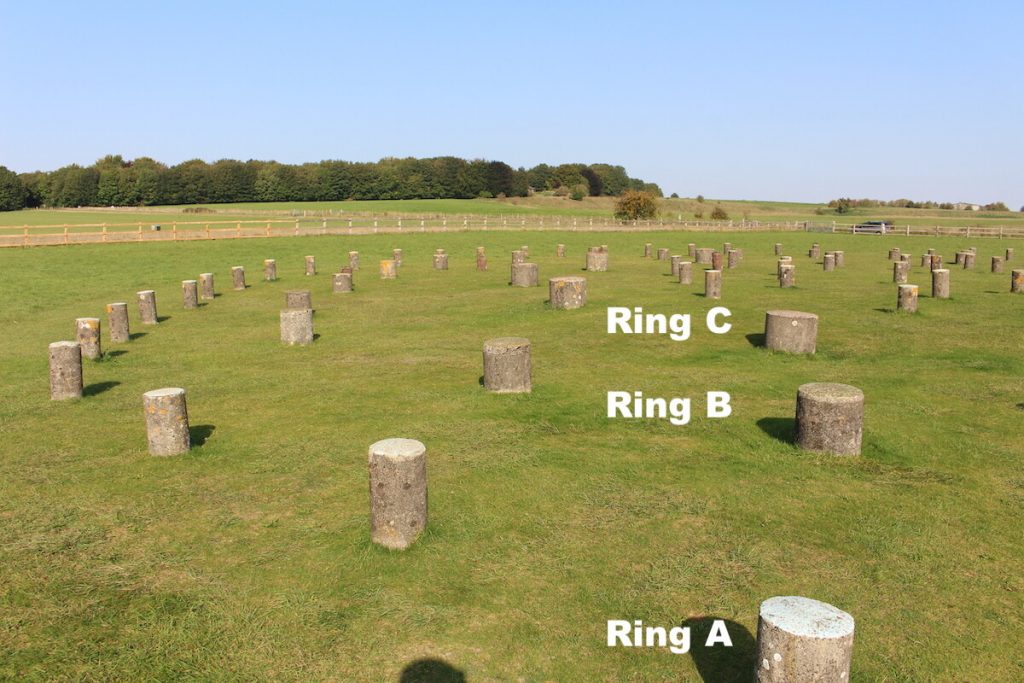
The exact layout of the wooden posts in these rings is also uncertain. However, Maud Cunnington identified the following number of post holes from largest to smallest:
- A Ring: 60 posts.
- B Ring: 32 posts.
- C Ring: 16 posts.
- D Ring: 18 posts.
- E Ring: 18 posts.
- F Ring: 12 posts.
Short concrete posts mark the position where the timbers once stood. These concrete markers help visitors understand the site’s layout and the various timber sizes used.
Towards the center of the rings is a cairn of flint. A pit in this location contained the remains of a crouched, three-year-old child with a split skull. The cracked skull may have occurred during a sacrifice or simply because of the soil’s weight on the body. Unfortunately, an examination of the corpse is no longer possible. An explosion destroyed the remains during the German blitz in World War Two.
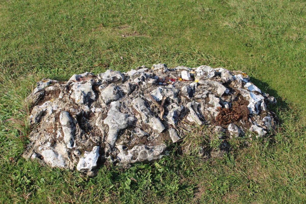
Additionally, the eastern side of the ditch contained the bones of a teenage male.
Relationship to Stonehenge
Woodhenge’s purpose and how it interacted with Stonehenge remain a mystery. Initially, experts believed it to be a prototype for Stonehenge. However, the construction of Stonehenge began about five centuries earlier. Others assumed it to be another burial mound, which is relatively common throughout the region.
Related: Stonehenge: A Megalithic Monument of Britain’s Ancient People
The oval rings appear to point to the summer and winter solstice — the same solstitial alignment as Stonehenge.
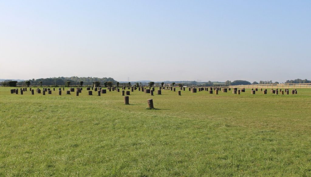
Although Stonehenge is only two miles away, the link between Woodhenge and Stonehenge is not a straight line. The banks and hedges from Stonehenge take several turns that stretch five miles before ending at the Avon River near the timber rings. This path goes by the name of “Stonehenge Avenue.”
Places of Life and Death
The current theory suggests it had a ceremonial purpose or was a place of offerings (archaeology.org). For example, researchers discovered pottery items, animal bones, deer antler picks, and flint tools placed by people at the base of posts.
The abundance of pig bones and other animal remains indicate feasts occurred here. Perhaps the two locations served opposing purposes, one for everyone to gather and celebrate and the other perhaps a sacred place to which only a few could enter.
It is speculated that the timbers symbolized life, a place for locals and travelers to enjoy festivities. Stonehenge, on the other hand, represented the afterlife, a burial place for the dead.
Southern Circle
In 1966, researchers identified another timber-based circle about 230 feet north of Woodhenge. Now called the Southern Circle, it is located in the Durrington Walls.
Sources
“History of Woodhenge.” English Heritage, 29 Sept. 2020.
The Henge Builders – Archaeology Magazine Archive, 29 Sept. 2020.
Collyer, Chris. Henge Timber Circle – Amesbury, Wiltshire, 29 Sept. 2020
Wikipedia, 29 Sept. 2020.
Stonehenge Stone Circle News and Information, 5 Feb. 2017.