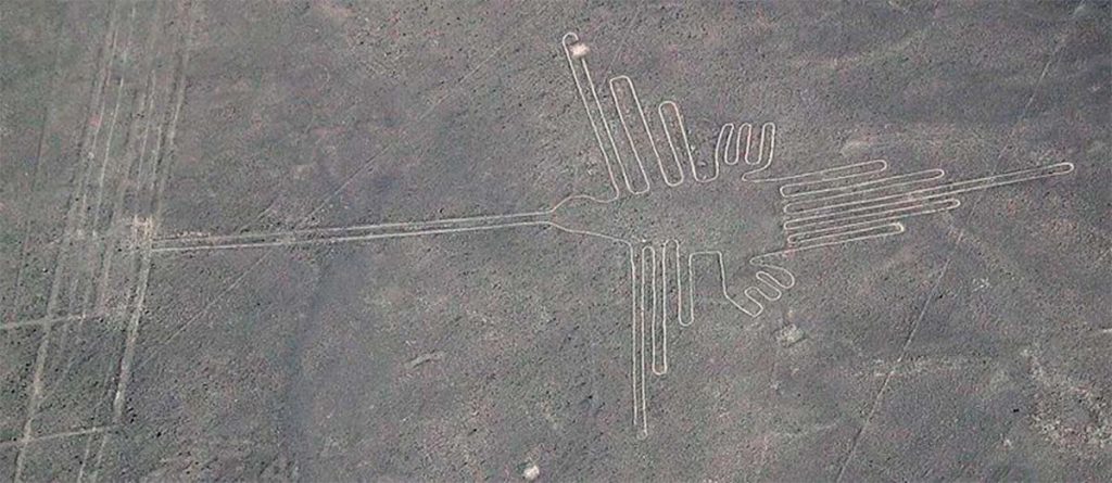
The most famous geoglyphs of South America are undoubtedly the Nazca lines. These strange man-made features, almost invisible from the ground, trace out lines, shapes and extraordinary depictions of animals across the arid desert plateau of southern Peru.
However there are others, less well known but no less fascinating. High in the Bolivian altiplano, the Sajama lines form their own unique combinations of circles, squares, and straight lines.
Unknown to the modern world until the start of the 20th century, these lines blanket the altiplano and may be up to 3,000 years old. Many theories have been put forward for them: were they created for religious, astronomical, or agricultural purposes?
Some have even proposed a connection between Bolivia’s geoglyphs and the Nazca. But the truth is we know almost nothing about this strange, patchwork landscape high in the Bolivian Andes.
A Man-Made Landscape
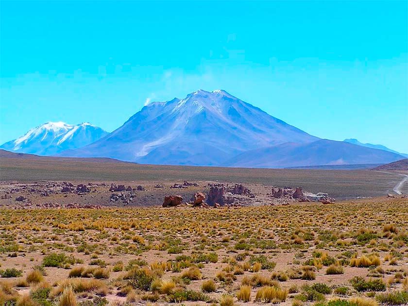
The Sajama lines, or the “Sajama figures” or “Sajama geoglyphs”, are an ancient grouping of geoglyphs situated near the Sajama volcano in the Bolivian altiplano. The group of ancient geoglyphs is a combination of circles, squares, straight lines, and other geometric shapes.
These geoglyphs were formed by scraping away the top layer of reddish-brown stones and releasing the lighter-colored ones underneath the soil. In this they are almost identical to the those created by the Nazca, and indeed the many chalk figures of northern Europe.

In 1932, the discovery of Sajama lines was revealed by the Swiss archaeologist and explorer Hans von Hagen, conducting one of the first western expeditions to the area. After that, many studies have been conducted on the group of ancient geoglyphs in an attempt to understand their significance and purposes.
Much research has been conducted to date, but still, the exact age of these ancient geoglyphs is unknown. Nor do we know who created them, but, many have speculated that the Tiwanaku culture who thrived near Lake Titikaka between 300 AD and 1000 AD may have been responsible.
These monumental builders, named for their famous temple city of Tiwanaku with its unique stone architecture, certainly had the capability to construct the geoglyphs. However, if it was the Tiwanaku then it is unique in all of their archaeology, and their purpose behind creating the Sajama lines remains a mystery.
One theory suggests that the group of ancient geoglyphs was developed for astronomical purposes. The geometric shapes may have been drawn to mark special celestial events like equinoxes and solstices.
Similarly, it has been proposed that the straight lines present in the Sajama lines may have been designed to observe the movements of stars, the sun, and the moon. The arrangement of the lines does seem to support this theory, where many of the lines are oriented to align with astronomical features like sunset and sunrise at certain times of year.
Another theory is that the group of ancient geoglyphs was developed for ceremonial or religious purposes. It has been observed that some of these shapes look like symbols of pre-Columbian cultures, like Peru’s Nazca lines.
Many have suggested that the geoglyphs at Nazca were designed for processional purposes. The geoglyphs are all formed from a single, unbroken line, and although they cannot be seen from the ground it may be that they were intended to be walked in some religious ritual.
Other facts have been presented to support this theory, such as the fact that many of the lines are situated near different archaeological sites and ancient ruins, which are also believed to be meant to be used for ceremonial or religious purposes.
However this is not the only theory. Some people believe that the Sajama lines were designed for agricultural purposes. These ancient geoglyphs could have been created and used to show areas for planting crops, and marking irrigation channels.
Many facts have also been presented to support this theory: for one the Sajama region is considered to have an arid and harsh environment that makes it difficult to conduct irrigation activity in the region. Thus, the creation of Sajama lines for agriculture activities could have helped them to improve their harvests.
A Link to the Nazca?
Research shows that there is a possible link between the Nazca lines in Peru and the Sajama lines in Bolivia. Nazca lines are another ancient geoglyph set that are situated nearly 800 kilometers (500 miles) to the south.
- Blythe Intaglios Geoglyphs in California’s Desert
- Who Made the Serpent Mound, the Largest Snake Geoglyph in the World?
Some similarities between these two ancient geoglyphs have been observed. Still, researchers and archaeologists have not found any definitive evidence to prove that both the Nazca lines in Peru and the Sajama lines in Bolivia are directly related.
Straight lines and geometric shapes are used, which is one of the notable similarities observed between the Nazca lines and the Sajama lines. These two sites both include shapes like trapezoids, circles, squares, and long straight lines. In addition, both sets of geoglyphs were built in the same fashion, as noted above.

However, some key differences were also identified between the Nazca lines and the Sajama lines. The Nazca lines are situated near the coast of Peru in a desert region, while the Sajama lines are situated in the Bolivian altiplano at a much higher elevation.
Further, the Sajama figures are found to be less complex and smaller as compared to the Nazca lines. The latter includes images of humans, animals, and other designs that are not in the Sajama geoglyphs.
Most conclude that the Nazca lines and the Sajama lines were designed by different cultures, at different places, and at different times. If the Sajama lines were made by the Tiwanaku culture they would be much younger than those of the Nazca, dating to between 300 AD and 1000 AD.
On the other hand, the Nazca lines were developed by the Nazca culture between 200 BC and 600 AD in Peru. But this rests on the assumption that the Tiwanaku made these lines in the altiplano, and there is no evidence for the date of the lines apart from this.
Could this be the work of an offshoot of the Nazca? Could these simpler forms, which cover the landscape more densely than those in Peru, be an even earlier and more primitive attempt to master the construction of these geoglyphs.
It seems impossible to tell.
Top Image: Sajama in the Bolivian altiplano: remote, inhospitable, and covered in a dense patchwork of geoglyphs. Source: Baba 496 / CC BY-SA 4.0.
By Bipin Dimri