At its height, the Inca Empire stretched almost the entire length of the Andes. The logistics required to unify this enormous territory, stretching from Colombia to Chile down the Andean spine of South America, were staggering.
There have certainly been larger imperial territories in history, both before and after that if the Inca, but in tying together these lands these people of the clouds faced some unique challenges.
Firstly, the landscape itself presented many obstacles. The Andes mountain range is among the largest and most inhospitable in the world, in many places impassable to this day. The Inca capital, in Cusco, was hidden away among the highest peaks: easily defended, but remote and inaccessible.
To maintain central control over this territory, a way was needed to link the Inca heartlands with the lush jungles of the Amazon to the east, and the arid coastal deserts to the west. And all this needed to be achieved without the wheel, useless to the Inca given the steep terrain and the lack of any beast of burden larger than a llama.
The Inca solution was a staggering feat of engineering. Spanning some 40,000 km (25,000) miles, the Inca road network, known as the Qhapaq Nan or “Royal Road” was the most advanced and extensive transportation system during pre-Columbian South America.
Qhapaq Nan
This network consisted of a network of formal roads that were carefully planned, built, maintained, marked, and engineered. These roads were paved only when there was a necessity. Stairways were also added to the road, where the gradient demanded it, and bridges spanned vast chasms, connecting seemingly unreachable parts of the empire.

Amidst the Inca road system, the water drainage system and the retaining walls were also prioritized. This foresight in planning made the roads durable and traversable in almost any weather, and much of the network survives to this day, thanks to the engineering genius of the Inca.
While the design and construction of the roads was centrally managed, individual populations were responsible for their maintenance. Some of these traditions survive right up to the modern day, such as the Inca rope bridge at Q’eswachaka in Peru.
A Monumental Undertaking
The central road of the Qhapaq Nan, also known as Main Andrean Road, ran through the Andes and was considered the backbone of the economic and political power of the Inca Empire. From this central system the administrative, ceremonial, and production centers of the last 2,000 years of pre-Inca Andean culture were connected.
- Machu Picchu Facts – 11 Fascinating Details of the Inca Citadel
- The Sky Fortress Of Kuelap And Cliffside Mummies Of The Chachapoyas
The Royal Road acts as the major route along the north-south axis of the Andes, running from Mendoza in Argentina to the Ecuadorian capital of Quito. There were actually two separate roads that followed this route, one each side of the Andes mountain chain. The route of the western coastal road is still followed today by the great Panamerican Highway.
Some of the roads were built on pre-existing routes, most notably used by the Wari and Tiwanaku in Peru and Bolivia. However the genius of the Inca was to take these localized systems and join them into one great, interconnected network which spanned their empire.
It took an immense labor force and an extreme effort of central planning to unify the empire physically and in an organized manner. In building this, the Inca understood that their empire could neither by won, nor held through force of arms alone.
Inca imperial governance was very different to most other empires. Many of the populations of the Andes were isolated, and the Inca preference was to absorb them into their empire through persuasion, rather than conquest.
They would arrive in a valley, descending as if from the clouds and telling of their mythical capital hidden far away on the mountain peaks. They would offer the peoples they met religious freedom, economic support, and food stocks in times of famine placed in prominent store houses called Qullqa on the slopes overlooking population centers – a very visible reminder of the benefits of being Inca.
Of course, they were backed by a magnificent army and often they would forcibly relocate uncooperative populations to other parts of their empire, but their hope was that the people they met would join them willingly. And as a tangible connection to this great, mythical mountain kingdom they welcomed you in to, they would connect you to their roads.
Manned by runners, it was said that the Inca in Cusco could eat fresh fish transported from the coast before it spoiled. Spanish conquistadors found treasures from all over the Andes at the Inca capital, including great bins of iridescent hummingbird feathers the nobility would use to adorn their clothing.

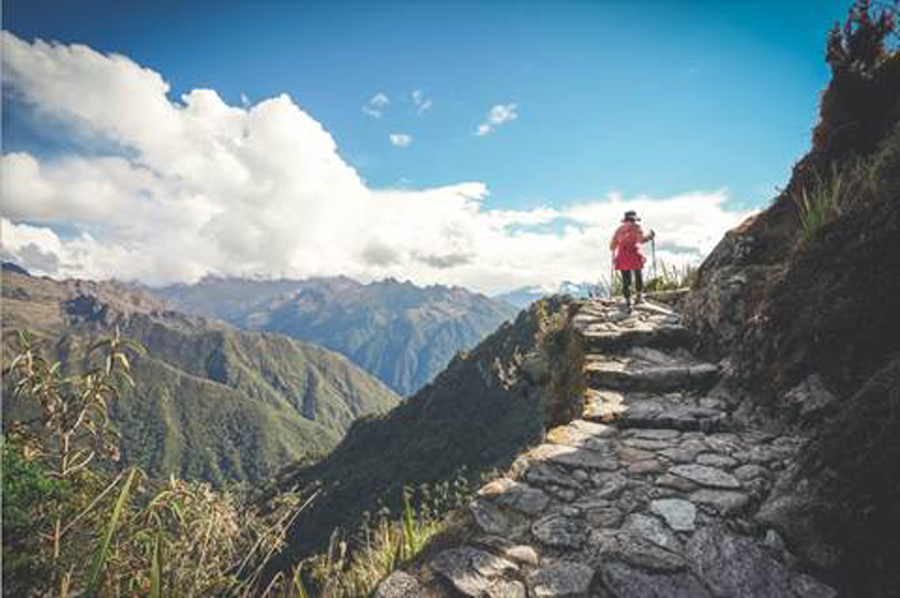
Much of the road network is covered by vegetation today, but some, such as the famous Inca route to Machu Picchu, is popular with tourists. Walking these high, narrow pathways is not for the faint hearted, but it is clear how these roads allowed access to the remotest areas of the Andes.
The Elite Route
Amidst the passageways made within the Inca road system, there was an Elite Route. The highland roads that the Incas constructed were for the elite people of the empire. It is said that these roads were built to permit the movement of people for the sake of imperial business.
Only the political administrators, troops, and workers who were heading in or out of the Inca empire for imperial business were permitted to take this route. The Inca empire also used them to collect taxes in the form of goods such as pottery and maize.
And these goods were then distributed across the Qullqa storehouses of the empire. These goods were the powerhouse which supported the empire, while the road system was the ligature that held the empire together.
The Wheel: Impractical and Unnecessary
One aspect of the Inca empire which often draws surprised comment is the different direction their innovation and development took compared to other civilizations. Their writing was based on a series of knots, and remains largely undeciphered.
They were masters of stonework and many Inca structures are more sturdy and stable than present day buildings. And, most surprisingly of all, they had not discovered that most basic of human inventions: the wheel.
Or at least, that was the prevailing opinion. But discoveries by western historians dating back to the 19th-century show that the Inca did have wheels. It was not a lack of innovation on their part, but the absence of a practical application.
The evident reason for not making wheeled carts or using wheels for travelling within the empire is mountain roads. There were sections in these passageways that were stepped and not just a linear path.

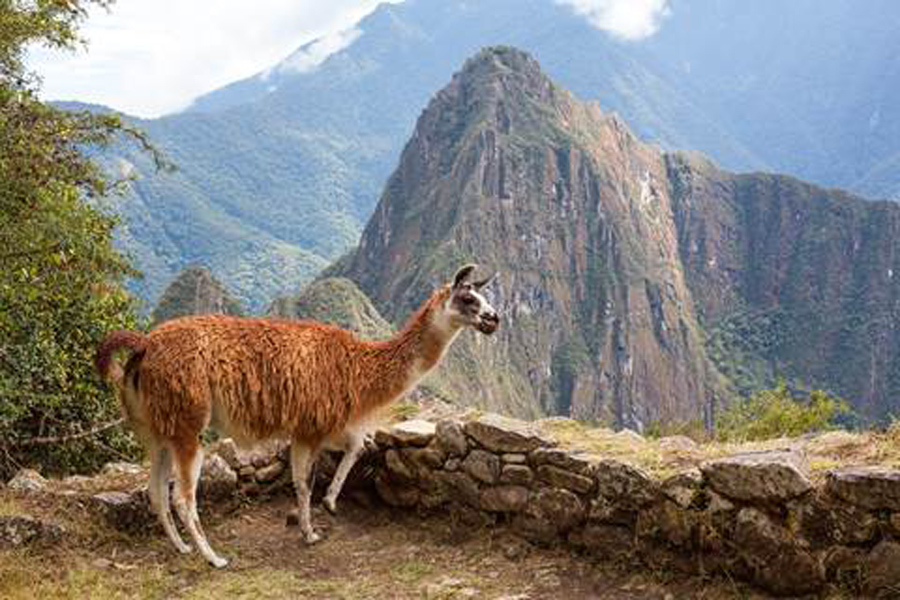
As of today, the mule is the perfect mode of transportation on these pre-Columbian roads. But Incas didn’t have mules back then but used llamas as an alternative for carrying goods through these roads, much more practical than a cumbersome wheeled cart.
This also made the road system very difficult for the Spanish conquistadors to traverse. The Inca capital of Cusco could indeed have been easily defended at almost any point as the Spanish struggled on horseback to navigate the roads towards it.
But the Inca did not react to the Spanish approach until they were literally on their doorstep. Defeated at Cusco and retreating into their mountain fastness at Ollantaytambo, their failure to act decisively lost them their capital and their empire.
Top Image: An Inca road in the high Andes of Peru. Source: Daniel Prudek / Adobe Stock.
By Bipin Dimri